Remember to always check trail conditions before hitting the trails
Rochester Valley Trails on Trailforks.comMAP DOWNLOADS:
ABOUT:
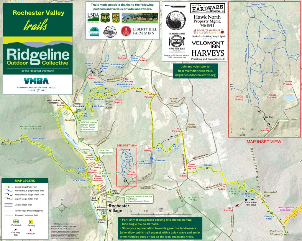
The Rochester Valley Trails boast great variety accessing multiple views of the narrow RT 100 valley through public and private lands. You can expect sections of the network to be challenging and adventurous considering the local mountainous terrain. The network is designed for multi-use, year round access for hikers, bikers, snowshoers and skiers. There are almost 20 miles of trails combining classic RAWchester rake and ride – Atlas, Link, Earls and Spreader – with the new machine built traIls which are turning Rochester into the Kingdom of Flow! Loop trails, Sap Boiler and Old Gents above the USFS Ranger Station are joined via Creamery Run to Boulder Dash on the west side of the White River connecting to the village center and the Velomont Trail (currently under construction) that will take you up out of the valley towards RT 73 and ultimately Pittsfield and beyond. The Randolph Gap Trail climbs the east wall of the valley with anticipated linking to Randolph and it’s network of trails. Parking for the network is available in town at Green Mountain Bikes, the town tennis courts, the park and ride at the north end of town, on RT 100, as well as the parking lot at the Ranger Station.


